“King Coal”
That is the name of a Pentrex video that I dubbed to DVD so I could take it on my trip as a primer to where I am going today. And may I say, I was quite impressed.
My stay at the Howard Johnson Inn was OK except for a few things I found wrong with the room. Both of them were to do with bad electrical outlets. The one between the beds was loose but useable but the clock radio was very funky. I went to set the alarm and the clock reset itself to a blinking 12:00 display. Plus even with the radio turned off via its volume control, you could still hear the thing. So that became unplugged. Then the outlet behind the TV set had a broken piece missing from the bottom outlet and there was this mini-fridge plugged in that just kept making this recycling noise even after it had chilled down. So that was unplugged. Needless to say that the morning clerk was informed of said anomalies.
My southward journey into the coalfields began at about 9am MDT. A beautiful sunny day with lots of cirrus-near-us as News8 Sergeant Gil would say. Still, a great day. About a half hour out of Gillette on Wyoming state route 59, I see a sign for one of the Thunder River coalmines. And I take the county road due east and wind up here:

This is a coal loading silo. The ramp you see from the top to the right is a part of a very long conveyor belt that brings coal from a crusher that makes the coal a burnable size.

Hopper cars go around a balloon track and then go thru the bottom of the silo where a pair of chutes load the coal. One loads the front of each car; the other loads the rear.

And in the distance, yet another mine just like what you have seen here. There are about 20 of these in the Powder River Basin.
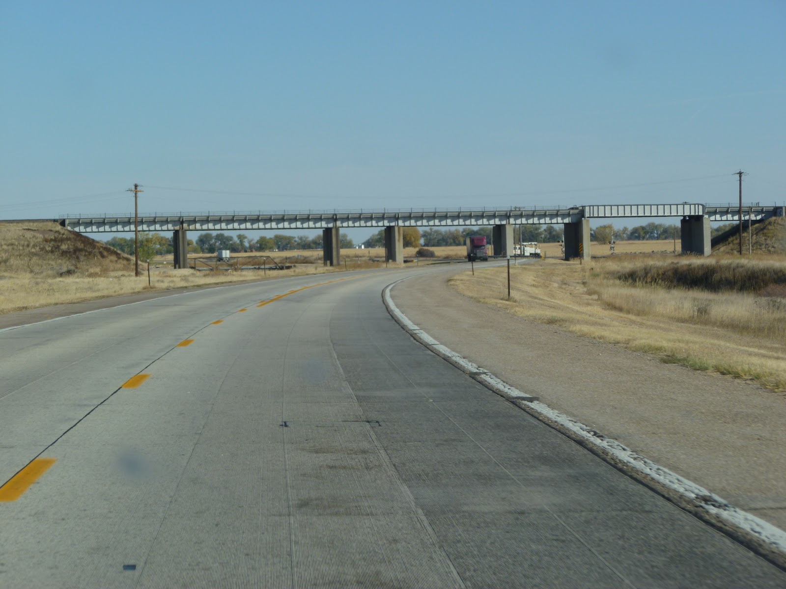
And here are pictures of the infrastructure of what is known as The Joint Line.


These mainline tracks are maintained by both the BNSF and UP. And unbeknownst to my Delorme mapping system, I had a county road that paralleled the Joint Line for about 10 miles. As far as I was concerned, I got to see a lot more than I had expected.
I headed further south on Wyoming State Route 59 and soon I arrived at the town of Bill.

And for some strange reason, the town was closed today. Nobody at the little store or at the post office. But across the street was a brand new, at least to me, hotel and diner.


They weren’t there when I was here back in October 1998 but must have been built for both the railroad and hunters who frequent the area.
And just down the street is a crew change point for the UP;

Complete with dormitories for crews away from home. After the coal trains leave Bailey Yard in North Platte, crews change out at South Morrill, Nebraska. From there, Bill is the next crew change. From Bill, a new crew takes the empty train to one of the mines and then comes back to Bill. Then the crew change process runs in reverse direction towards North Platte.
And a few more shots of the Joint Line: a BNSF loaded coal train:

As it passes a slower UP loaded coal train:

As you can tell, there's plenty of business to go around.
At one point south of Bill, the railroad heads to the southeast and Route 59 heads to the southwest towards the town of Douglas. After grabbing a buffet lunch at Pizza Hut, it is south on I-25 and exit at Orin and then east on U. S. Route 16. As I go further east, I meet up with the UP and see this remarkable triple track mainline. All of this impressive railway in the middle of nowhere.


But still, it is the vital link with keeping coal moving to power plants in the east. And the backdrop of the Wyoming prairie is just beautiful.


But still, it is the vital link with keeping coal moving to power plants in the east. And the backdrop of the Wyoming prairie is just beautiful.

And at the small town of Keeline, I happen to catch an eastbound loaded coal train and a westbound empty coal train.

Can’t get better timing than that and squarely in front of me. How cool is that??!!
A few minutes later and I am in the small city of Lusk, Wyoming. Wide streets complete with the changing of the leaves:


And just the north of the center of the city, empties going west:

Soon it is south on U.S. Route 85 to the town of Lingle and then southeast on U.S. Route 26 thru Torrington, Wyoming and we cross back into Nebraska at the town of Henry:

Soon you enter Morrill with the familiar bridge carrying the UP South Morrill Sub from the Power River Basin over the other King Coal player BNSF.
A few more main roads and in the distance I see my last stop of the day:

Scotts Bluff National Monument

After getting my ticket and climbing the paved goat path:


You arrive and the views is just breathtaking:


And, oh yes:

And a few more:


And today’s U.S. Route 92, which gets you to the entrance of the park, is what once was the original path of the Oregon Trail. What our forefathers must have thought.
At about 5pm MDT, the traveling comes to an end. I’ll be meeting up with a ham radio friend of mine for dinner, and then I will call it a night.
And before I forget, a small piece of business. I gave my Dad a call on Monday to check in and see how he and Mom were doing. He said he's been enjoying the blog and liked the shout-out I gave to the Air Force and his time with the 450th Bomb Group during WWII. He said that I did not mention the B-24 airplanes that he worked on at the base in Manduria, Italy. So for that, I ask you to check 2 sites that my Dad goes to. The first one is www.450thbg.com where you can find out more about the squadrons known as The Cottontails. The second website is The Collins Foundation at http://www.collingsfoundation.org/ where you will find information about the Wings Of Freedom Tour which features a B-24 like the one my Dad worked on. The tour is currently in the South but will be back in Connecticut next year. Please check these sites out and thanks from my Dad.
Wednesday we follow the UP southeast, then south, then west towards Cheyenne. Hope you’ve been enjoying the ride. We’ll see you then.
I’m Philip J Zocco. On The Road. In Scottsbluff, Nebraska.
No comments:
Post a Comment